Infosuperior is glad to receive input from readers. Feel free to get in touch with us with comments or to suggest topics for articles. Recently, in response to information about mapping tools posted in Infosuperior’s January 31st newsletter, Brian Huberty of the U.S. Fish and Wildlife Service and based in Bloomington, Minnesota, wrote to suggest that links to the Minnesota Department of Natural Resources Landview Mapping tool be provided on the Infosuperior site.
Brian also suggested a few revisions to enable more effective navigation of Infosuperior’s online maps page. The page contains everything from a live, interactive Great Lakes water level viewer to a “story map” providing information about cleanup projects in Thunder Bay Harbour.
Brian also kindly provided the following article about the Landview mapping tool, a fascinating way of exploring Lake Superior’s Minnesota shorline and an extremely useful tool for environmental initiatives and decision-making. Thanks for the article Brian. Here it is…
DIRECT LINK TO MINNESOTA LANDVIEW
DIRECT LINK TO INFOSUPERIOR’S MAPPING PORTAL
The Minnesota Dept. of Natural Resources ‘Landview’ webmap page has a long history going back to the dawn of the internet…..the Post-Pleistocene Epoch or it has been commonly called, the Infocene Epoch.
Landview evolved from the NASA funded FORNET project to the University of Minnesota started in the 1990’s to serve forest inventory maps via the ForestView webpage.
Forest inventory polygons were ovelaid on aerial and Landsat imagery over analog telephone dial-up 33k modems to MN DNR field offices. The core software was Mapserver which was the first common, open source webmapping software used around the world to serve maps and remote sensing imagery over the internet.
 Given the very limited telephone networks of the time, Mapserver still is a very efficient and fast webmap delivery system. Fifteen years ago, very complex Mapserver image ortho webmaps like using LandView would take one minute to load over analog telephone lines while it would take over ten minutes to load the same imagery using commercial software web mapping pages.
When one goes to the Landview website, you see this:
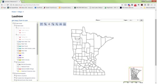
Minnesota counties with a long list of options on the left side to check and activate.
The key layers to check out are:
Historic air photos

These colored dots represent geo-referenced scanned aerial photos dating back to the 1930’s for most of the state.
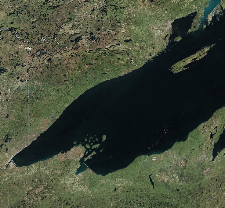
This example with the CIR backdrop shows a variety of imagery available to view over the Duluth Harbor. To see the image, one needs to activate just to the right of and click on a colored dot.

In this example, another window pops open with an 8-13-39 (1939) image of the port before WWII:

One can download the full resolution image by clicking on the link.
Here is what the Duluth Lift Bridge and harbor entrance looked like back then:

Fall Peak Color CIR Aerial Photos:
The red squares illustrate the aerial photos that might be available for all forested counties in Minnesota:

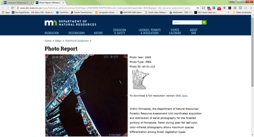
Here is one example from 2005:

Oblique Coastal Aerial Photos:
Finally, LandView also serves up oblique Coastal Zone Management photos as shown by the colored dots in this overview map:
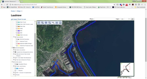
Again, using the same procedure as before, pick a colored dot and this new window will pop up:

And again, you can download the full image using the link. In this case, this is a 2012 shot of the Duluth Aerial Lift Bridge and Canal Park:

Landview was developed by the Minnesota DNR using the University of Minnesota MapServer software.